Simulate ONS for a solar sail near the L1 Lagrange point
This only simulates the orbital motion.
Contents
%--------------------------------------------------------------------------
%   Copyright (c) 2021 Princeton Satellite Systems, Inc.
%   All rights reserved.
%--------------------------------------------------------------------------
Constants
rE        = Constant('equatorial radius earth');
rS        = Constant('sun radius');
muSun     = Constant('mu sun');
aU        = Constant('au');
secToDay  = 1/86400;
secInYear = 365.26*86400;
kEarth    = 3; % SPICE numbering 1-9 are the planets, 10 is the moon
earth     = 1;
sun       = 2;

% Get the defaults
dRHS      = RHSHelioMission;
Script control
viewersOn = true;
printAll  = false;


% acceleration model
massFuel	= 0;     % kg
dRHS.mD   = 100;   % kg
dRHS.uE   = inf;

% solar sail parameters
area = 1650; % m2
optical    = struct('sigmaS',[0.898 0.865],...
                    'sigmaD',[0.02  0.035],...
                    'sigmaA',[0.08  0.098]);
emissivity = [0 0.3];

% Add Earth for CRTBP?
plotRef = {'Sun' 'Earth'};

% Initialize the ephemeris
PlanetPosJPL( 'initialize', kEarth )
% yDot = RHSCRTBP( t, y, mu )

% Initialize the state
dRHS.ref    = sun;
jD0         = Date2JD([2024 8 3 0 0 0]);
dT          = 10000;
tEnd        = 5*2e6; % sec, 3e7

% This halo state does not take into account the sail's force
[r0, mu, v0] = PlanetPosJPL( 'update', jD0 );
[rH,vH,p] = HALOState( 0.005,0.01,0,0, 'SEM', 1, 0 ); % non-dimensional
rH = rH*Mag(r0);
vH = vH*aU/Constant('earth year')*2*pi;
% TransSEMRToHelio this was using the unit vector of the sun backwards!!
% deltas from Earth position may be in ecliptic
[rECI,vECI] = TransSEMRToEq( jD0, rH, vH );

x = [rECI;vECI;massFuel];
dRHS.mu(1)   = mu; % set the mu for the right planet

% Set the Julian date for the dynamical model
dRHS.jD0 = jD0;

% Simulation steps
n     = ceil(tEnd/dT);
Setup the camera data structure
dCam	= NavigationCamera;
dGPS  = MeasGPS;
dGS   = MeasRangeGroundStation;
dOM   = MeasStarAngleAndChord;
Add noise
dCam.camera.sigmaXY = 1;
dCam.camera.noise   = true;
dCam.namePlanet     = {'Earth' 'Sun'}; % Earth?
dCam.radiusPlanet   = [rE rS];
Set up the displays
TimeDisplay('initialize','ONS Simulation',n);

if( viewersOn )
  hNav = StarCameraViewer('initialize','Navigation Camera', n ); %#ok<*UNRCH>
end

% The time vector
t       = (0:n-1)*dT;


Setup Optical Navigation
dONS      = OpticalNavigation;
r         = x(1:3);
v         = x(4:6);

dONS.ukf.fData      = RHSUKFHelioMission;
dONS.ukf.fData.jD0  = dRHS.jD0;
dONS.target         = sun; % 1 or 2?
dONS.ukf.fData.ref  = sun;

% Initialize ONS
dONS                = OpticalNavigation( 'initialize', dONS, r, v, dT );
meas.optical        = NavigationCamera( r, dCam );

% Set up the parameters in ONS
dONS.t            	= t(1);
dONS.useUKF        	= true;
dONS.ukf.useOptical	= false;
dONS.ukf.useState 	= false;
dONS.ukf.usePos     = false;
dONS.ukf.f          = @RHSUKFHelioMission;
dONS.aBody1         = rE;
dONS.aBody2         = rS;
dONS.rSwitch        = 1e10; % km Switching distance between the two targets

% Plotting arrays
xP      = zeros(21,n);
target  = zeros(1,n);
type    = zeros(1,n);
nStars  = zeros(1,n);
Run the simulation
hLast = dT;
for k = 1:n

  % ONS simulation
	TimeDisplay('update',k);

  % Determine if the spacecraft has hit the ground
  h = Mag(x(1:3))-rS;

  % Get data for plotting
  [~,~,~,acc] = RHSHelioMission(x,t(k),dRHS);

  % Get the location and velocity of Earth
  [rEarth,~,vEarth] = PlanetPosJPL( 'update', jD0 + t(k)*secToDay );

  if( dRHS.ref == earth )
    dCam.xPlanet = [[0;0;0] -rEarth];
    rEarth        = [0;0;0];
    vEarth        = [0;0;0];
  else
    dCam.xPlanet = [rEarth [0;0;0]];
  end

  % Stop on landing
  if( h <= 0 )
    break;
  end

	% The camera boresight points at the target xCam is in the ECI frame
  rCam = x(1:3);
  vCam = x(4:6);

  % Needed to point the camera
  dONS          = OpticalNavigation( 'get unit vector', dONS, rEarth, vEarth, rCam, vCam );

	% Get the measurements
  meas.jD0      = jD0 + t(k)*secToDay;
  meas.state    = x(1:6);
  meas.acc      = acc;
  dCam.q        = U2Q(dONS.uC,[0;0;1]);
	dOM.cam       = NavigationCamera( rCam, dCam );
	dOM.type      = dONS.type;
  dOM.target    = dONS.target;
  dOM.ref       = dRHS.ref;
  dOM.uCamera   = dONS.uCamera;
  dOM.aBody1    = dONS.aBody1;
  dOM.aBody2    = dONS.aBody2;
  dOM.r1        = rEarth;
  dOM.v1        = vEarth;

	meas.state    = x(1:6);
  meas.acc      = acc; % Spacecraft non-gravitational acceleration
  meas.gps      = MeasGPS( x, dGPS );
  meas.gs       = MeasRangeGroundStation( x, dGS );
  meas.optical  = MeasStarAngleAndChord( [rCam;vCam], dOM );

  % ONS
	dONS.cam      = dOM.cam;
  dONS.ref      = dRHS.ref;
  dONS.r1       = dOM.r1;
	dONS.v1       = dOM.v1;
  dONS.t        = t(k);
  dONS          = OpticalNavigation( 'update', dONS, meas, rEarth, vEarth, rCam, vCam );
  target(k)     = dONS.target;
  type(k)       = dONS.type;
  nStars(k)     = dONS.ukf.optical.nStars;

  % Display the cameras
  if( viewersOn )
    StarCameraViewer('update', dOM.cam, [], hNav, dCam, k);
  end
	xP(:,k)        = [x;rEarth;dRHS.thrust;dRHS.ref;h;dONS.x];

  % Propagate the state
  uSun       = -Unit(rCam); % SJT is this always true?
  nB         = uSun; % guidance would  go here, rotating off sun vector
  flux       = SolarFlx( Mag(rCam)/aU );
  [f, T, fT] = SolarPressureForce( area, nB, uSun, flux, optical, emissivity );
  dRHS.thrust = fT*1e-3;
  %x           = RK4(@RHSHelioMission,x,dT,t(k),dRHS);
  [x,hLast]   = RK45(@RHSHelioMission,x,hLast,dT,0.1*dT,[],t(k),dRHS);
end

TimeDisplay('close');
Plotting
% Shorten the vectors if it hits the ground
j           = 1:k;
xP          = xP(:,j);
t           = t(j);
target      = target(j);
type        = type(j);
nStars      = nStars(j);

% Make earth and sun referenced positions
rSun        = zeros(3,k);
rEarth      = zeros(3,k);
j           = find(xP(14,:) == earth );
rEarth(:,j) = xP(1:3,j);
rSun(:,j)   = xP(8:10,j) - rEarth(:,j);

j           = find(xP(14,:) == sun );
rSun(:,j)   = xP(1:3,j);
rEarth(:,j)	= xP(8:10,j) - rSun(:,j);

% Sun/Mars plot
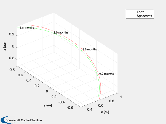
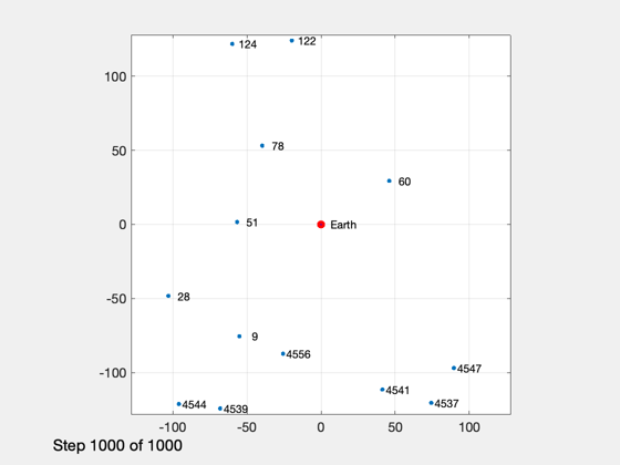
HelioPlot( 3, t(end)/secInYear, jD0, xP(1:3,:), {'Spacecraft'} )

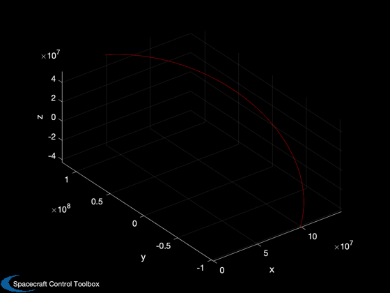
PlotSEMTraj( xP(1:3,:), 'ECI', jD0+t*secToDay )

% Time histories
[t,tL]      = TimeLabl(t);
yL          = {'x (km)' 'y (km)' 'z (km)'};
yD          = {'a_x (km/s^2)' 'a_y (km/s^2)' 'a_z (km/s^2)'  'H (km)' '|a| (km/s^2)'};
yS          = {'x (km)' 'y (km)' 'z (km)' 'v_x (km/s)' 'v_y (km/s)' 'v_z (km/s)'};

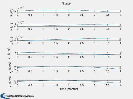
Plot2D(t,xP(1:6,:),tL,yS,'State');
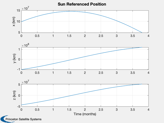
Plot2D(t,rSun, tL,yL,'Sun Referenced Position');
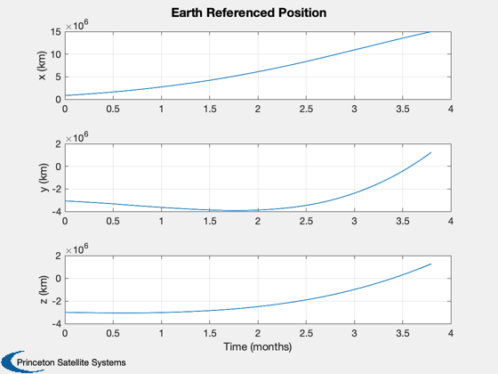
Plot2D(t,rEarth,tL,yL,'Earth Referenced Position');
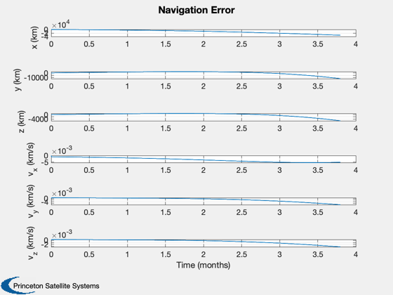
Plot2D(t,xP(16:21,:) - xP(1:6,:),tL,yS,'Navigation Error');
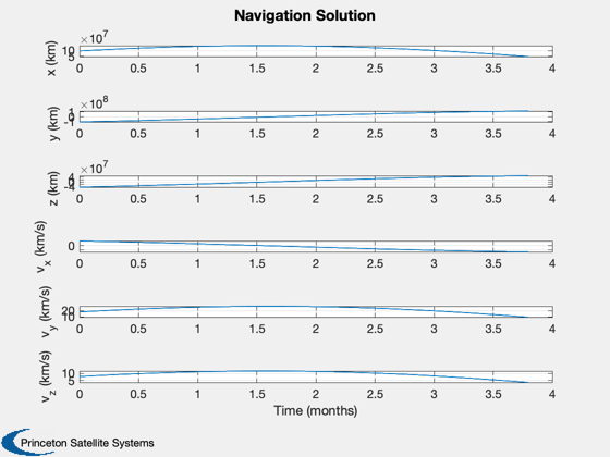
Plot2D(t,xP(16:21,:),tL,yS,'Navigation Solution');

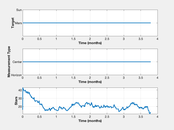
NewFig('Targeting')
subplot(3,1,1);
h = plot(t,target);
set(h,'linewidth',2);
grid on
XLabelS(tL);
YLabelS('Target')
set(gca,'ytick',[1 2],'yticklabel',{'Mars' 'Sun'});

subplot(3,1,2);
h = plot(t,type);
set(h,'linewidth',2);
grid on
XLabelS(tL);
YLabelS('Measurement Type')
set(gca,'ytick',[1 2],'yticklabel',{'Horizon' 'Center'});

subplot(3,1,3);
h = plot(t,nStars);
set(h,'linewidth',2);
grid on
XLabelS(tL);
YLabelS('Stars')

Figui

if( printAll )
  n = get(gcf,'number');
  for k = 1:n
    PrintFig(1,4,k,sprintf('%s%d',simName,k));
  end
end

function [rEq,vEq] = TransSEMRToEq(jD, rSEMR, vSEMR)
% Transform from SEMR to equatorial, sun-centered frame

mu  = Constant('mu sem');            % non-dimensional system mass parameter
L   = Constant('au');                % length unit (1 AU) (km)
T   = Constant('earth year');        % time unit (Earth year) (sec)
muSun = Constant('mu sun');        % km

rEq = 0*rSEMR;
vEq = 0*vSEMR;
for k = 1:length(jD)
  m{k} = CEcl2Eq(jD(k));
  rECI = m{k}*( rSEMR(:,k) - [1-mu; 0; 0]*L );            % position
  vECI = m{k}*( vSEMR(:,k) );% + [0; 1-mu; 0]*L*2*pi/T ); % velocity
  [u, r]      = SunV2( jD(k), [0;0;0] ); % current sun vector from Earth
  sunDist     = -u*r; % position of Earth rel to sun in km
  rEq(:,k)    = rECI + sunDist;
  vDirection  = m{k}*cross(-u, [0; 0; 1]); % from ecliptic to equatorial
  vDirection  = vDirection/norm(vDirection);
  vMag        = sqrt(muSun/L);
  vEq(:,k)    = vECI - vDirection*vMag;
end
end


%--------------------------------------
ans =
  Figure (PlotPSS) with properties:

      Number: 6
        Name: 'ECI'
       Color: [0 0 0]
    Position: [560 528 560 420]
       Units: 'pixels'

  Use GET to show all properties
